Atlases Charts and Maps
Showing the single result
-

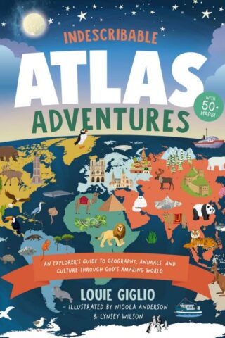
Indescribable Atlas Adventures
$23.19With more than 50 infographic maps, this illustrated world atlas for kids from bestselling author Louie Giglio will stretch your children’s understanding of the world as they discover more about God, science, and His amazing world!
Indescribable Atlas Adventures offers a self-guided tour for your favorite explorer throughout the seven continents and over 50 countries. Easy-to-read maps, more than 1,500 facts, and a world map that helps kids identify each continent and country will help your child to think globally and discover new insights into God’s incredible creation. Each map includes:
*an overview of each country’s population, languages, and prominent features;
*key facts about the country’s capital cities; neighboring countries; and the national bird, tree, and dish;
*notable people and their amazing achievements;
*the country’s terrain, climate, wildlife, contributions to space exploration, cultural hallmarks, and Christian faith traditions; and
*biblical and inspirational pieces, like devotional thoughts, prayers, and Bible verses that highlight how amazing God and His world are.
Indescribable Atlas Adventures is for ages 6 to 10 and spotlights several fascinating ecosystems, like the Sahara, Amazon, and Great Barrier Reef. This book has a large trim size to help kids explore fun details on each page and is a perfect “my first atlas of the world” gift for curious kids.
Add to cartIn stock